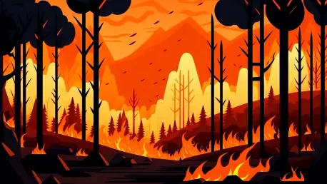

What happens when a tool meant to shield communities from raging wildfires becomes the spark for public outrage? In Oregon, a state scarred by devastating blazes, a pioneering effort to map wildfire risks and protect lives was reduced to ashes—not by flames, but by a wildfire of misinformation. This digital-age disaster unfolded as homeowners, fueled by confusion and false narratives, turned against a science-based solution designed to save them. The story of this collapse reveals a chilling truth about the power of distrust in an era where facts struggle to compete with fear.
The Stakes of a Burning State
Oregon’s forests and rural landscapes have long been at the mercy of fire, but the ferocity of recent wildfire seasons has pushed the state to a breaking point. With climate change intensifying heat and drought, the need for innovative defenses has never been clearer. A risk map, rolled out to identify vulnerable areas and enforce fire-safe building standards, promised to be a lifeline. This initiative held the potential to position Oregon as a leader in disaster preparedness, addressing a crisis that has already destroyed thousands of homes. The significance of this tool cannot be overstated—it was a chance to outsmart nature’s fury with data and strategy.
A Map Ignites Controversy
The rollout of the wildfire risk map began with high hopes but quickly stumbled into chaos. Homeowners across the state received letters labeling their properties as “extreme risk,” often with little explanation or guidance on what it meant. The lack of a robust communication plan left many feeling blindsided, as the state failed to prepare communities for the implications of these designations. Confusion morphed into anger at town halls, where heated exchanges sometimes escalated to threats, derailing any chance for constructive dialogue. What was meant to be a protective measure became a lightning rod for frustration.
This initial misstep opened the door to a flood of misinformation. Social media platforms buzzed with rumors, as groups with thousands of members spread claims that the map was a government plot to control rural land. Conservative media amplified wild conspiracies, suggesting ties to global agendas that had no basis in reality. Meanwhile, unrelated insurance premium hikes were wrongly pinned on the map, despite clear statements from regulators that insurers used separate risk models. The narrative of betrayal took hold, drowning out the map’s true purpose.
Voices of Frustration and Expertise
Amid the uproar, the human toll of this controversy came into sharp focus through the words of those directly affected. Chris Dunn, the wildfire risk scientist who spearheaded the map’s creation, expressed dismay at how quickly public perception spiraled out of control, noting that early warnings about communication gaps went unheeded by state officials. His frustration highlighted a disconnect between scientific intent and public reception, a gap that proved impossible to bridge once trust eroded.
Homeowners caught in the crossfire shared raw accounts of their struggles. One rural resident described the panic of receiving a risk label while simultaneously facing an insurance cancellation, feeling as though the state had marked their property as a liability. On the other side, Oregon’s insurance regulator, Andrew Stolfi, worked to debunk myths, emphasizing that the map played no role in underwriting decisions—a fact lost in the noise of online outrage. These contrasting perspectives painted a picture of a policy undone by misunderstanding.
Adding depth to the debate, Rep. Dacia Grayber, a firefighter-turned-lawmaker, stood as the lone voice against scrapping the map. Her firsthand experience with wildfire devastation fueled a passionate argument for prioritizing safety over political pressure. “This isn’t just data on a page—it’s lives at stake,” she declared, a plea that fell on deaf ears as the tide of opposition swelled. Her stance underscored the real-world consequences of abandoning such tools.
The Political Firestorm and Repeal
As public anger mounted, the issue became a political hot potato that few could ignore. Republican lawmakers seized on constituent discontent, branding the map as an overreach that burdened rural families with unnecessary rules. Even some initial supporters among Democrats wavered under the weight of community backlash, unable to counter the pervasive narrative of harm. By 2025, the push to dismantle the map gained unstoppable momentum, reflecting how deeply misinformation had reshaped the conversation.
The final blow came with a near-unanimous legislative vote to repeal the map and its associated mandates. Signed into law, this decision erased a critical safety mechanism, leaving Oregon more exposed to future wildfire threats. The repeal wasn’t just a policy reversal—it was a surrender to fear over fact, a stark reminder of how quickly a well-intentioned plan can be consumed by public distrust. The lone dissenter’s warnings about long-term risks echoed as a haunting footnote to the debacle.
Lessons from a Policy Inferno
While the map may be gone, its failure offers vital insights for preventing similar disasters in other states or future initiatives. Effective public engagement stands out as a non-negotiable first step—clear, early education campaigns can demystify complex tools and build a foundation of trust. Partnering with local leaders to deliver accurate information in real time could also stem the tide of false claims before they spread unchecked. These strategies demand investment but promise to align communities with the science behind safety measures.
Another path forward lies in learning from alternative models. States like Colorado have shown success by incentivizing homeowners to reduce risks through insurance discounts, creating a shared stake in preparedness. Adapting such approaches could help Oregon rebuild a framework where individual actions and collective goals reinforce each other. The key is to design policies that feel less like impositions and more like partnerships, a balance that was sorely missing in this case.
Looking ahead, tackling misinformation head-on remains an urgent priority. Establishing rapid-response teams to address rumors on social media and in local forums could protect future policies from being derailed by falsehoods. As climate-driven threats grow, the need for data-driven solutions only intensifies. Oregon’s experience serves as a cautionary tale, urging policymakers everywhere to prioritize trust as much as technology in the fight against nature’s wrath.
Reflecting on a Lost Opportunity
Looking back, the downfall of Oregon’s wildfire risk map stood as a tragic missed chance to fortify a state under siege by nature’s fury. Lawmakers had bowed to a wave of misinformation, dismantling a tool that could have saved countless homes and lives. The scars of that decision lingered, a reminder of how fragile public trust could be when communication faltered. Yet, from those ashes emerged hard-earned wisdom: future efforts needed to root themselves in transparency and community buy-in from the start. Only by forging stronger bonds between science and society could states hope to stand firm against the wildfires—and falsehoods—of tomorrow.