I’m thrilled to sit down with Donald Gainsborough, a renowned political savant and leader in policy and legislation, who is at the forefront of innovative urban solutions as the head of Government Curated. Today, we’re diving into the groundbreaking digital twin initiative in the greater Phoenix area, a project that promises to transform how cities collaborate on pressing issues like traffic, housing, and climate challenges. Our conversation explores the concept of digital twins, the motivations behind this multi-jurisdictional effort, the integration of diverse data sources, and the potential impact on urban planning, public safety, and community engagement. Let’s uncover how this virtual replica of a region could shape the future of smart cities.
Can you start by explaining what a digital twin is in simple terms for those who might not be familiar with the concept?
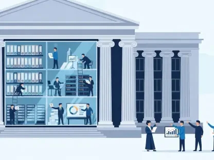
Absolutely, I’m happy to break it down. A digital twin is essentially a virtual mirror of a real-world place or system—in this case, a city or region. It’s a detailed, dynamic model that reflects the physical environment, infrastructure, and even behaviors like traffic flow or energy use. By creating this digital version, we can monitor what’s happening in real time, run simulations to predict outcomes, and test solutions without touching the actual city. It’s like having a sandbox to experiment in, helping us understand complex issues and make better decisions before committing resources.
What inspired the greater Phoenix area to develop a multi-jurisdictional digital twin across several cities?
The Phoenix region, with nearly 5 million residents, faces challenges that don’t stop at city borders—think traffic jams, housing shortages, and extreme heat. These issues are interconnected, so a single city working alone can’t fully address them. The idea behind this digital twin, spearheaded by a regional smart city consortium, is to bring cities like Phoenix, Tempe, and Mesa together under one virtual platform. Collaboration allows for a broader perspective, capturing how one city’s traffic affects another’s or how housing policies ripple across the region. It’s about breaking down silos to tackle shared problems more effectively.
How does this digital twin bring together data from such varied sources to create a unified picture?
That’s one of the most exciting aspects. The digital twin pulls in data from multiple streams—think Google Maps for geographic and traffic details, local government records for infrastructure and zoning, and even artificial intelligence to analyze patterns and predict trends. The challenge is that each city might use different systems or formats, so a big focus is on standardizing this information to ensure it’s compatible. By creating a cohesive dataset, the twin offers a comprehensive view of the region, allowing planners to see how everything interacts, from road networks to weather impacts, in one shared space.
What are some of the major regional challenges this digital twin is designed to address?
The potential is vast, but key focus areas include traffic congestion, housing affordability, heat mitigation, and urban planning. For traffic, it can simulate cross-city flows to identify bottlenecks and test solutions like new bus routes. On housing, it could model development scenarios to balance growth with affordability. For heat, a major issue in Arizona, it might help plan green spaces or cooling infrastructure. And in urban planning, it allows cities to align their strategies, ensuring that growth in one area complements another rather than creating conflict. It’s about seeing the bigger picture.
Can you walk us through a specific example of how the digital twin might improve something like transit connectivity between cities in the region?
Sure, let’s take transit between Tempe and Mesa as an example. Right now, their systems often operate independently, stopping at city limits, which frustrates residents who need to cross those boundaries for work or daily life. Jurisdictional rules and funding priorities make coordination tough. With the digital twin, planners can visualize both systems side by side, simulate passenger flows, and test ideas like shared routes or transfer hubs. It provides a clear picture of where the gaps are and what solutions might work best, making it easier to justify and plan for connectivity that benefits everyone.
In what ways could this technology support contractors and developers working in the Phoenix area?
Developers and contractors face a real headache dealing with varying rules and regulations across cities in the region. Each municipality might have different zoning laws or permitting processes, which adds time and cost to projects. The digital twin offers a unified platform where they can access standardized data, model their projects virtually, and see how they align with local requirements before breaking ground. This cuts down on guesswork, reduces compliance costs, and speeds up development timelines. It’s a game-changer for making construction more efficient and predictable.
How might the digital twin contribute to enhancing public safety across these cities?
Public safety is a huge area of potential. The digital twin can integrate data on crime patterns, emergency response times, and even weather events to help cities prepare and react better. For instance, it could simulate how a major incident in one city might spill over into another, allowing for coordinated police or fire responses across borders. It can also help identify high-risk areas for targeted interventions, like better lighting or traffic calming measures. Ultimately, it’s about creating a safer environment by anticipating problems and planning responses proactively.
How do you envision the digital twin fostering greater community engagement in the region?
I see it as a powerful tool to bring residents into the planning process. Imagine a public-facing version of the digital twin where people can explore proposed changes—say, a new park or transit line—and provide feedback directly. It could make urban planning more transparent and interactive, helping citizens understand how decisions affect their neighborhoods. By visualizing future scenarios, it also builds trust and connection between communities and their leaders, ensuring that development truly reflects the needs and voices of the people living there.
What do you see as the biggest obstacles in creating and rolling out a digital twin across multiple jurisdictions like this?
The hurdles are significant, no doubt. First, there’s the technical challenge of integrating data from cities with different systems and levels of tech adoption—standardization takes time and resources. Then, there’s the issue of governance: getting multiple jurisdictions to agree on priorities, funding, and data-sharing protocols can be politically tricky. Privacy and security are also concerns, as handling large amounts of regional data requires robust safeguards. Overcoming these barriers demands strong leadership, trust-building, and a shared commitment to the long-term benefits of collaboration.
What is your forecast for the future of digital twins in urban planning and smart city development?
I’m incredibly optimistic about where digital twins are headed. As technology advances, particularly with AI and real-time data integration, these tools will become even more precise and predictive, allowing cities to plan decades ahead with confidence. I foresee them becoming standard in urban management, not just for large regions like Phoenix but for smaller towns too, as costs decrease and accessibility improves. They’ll drive smarter, more sustainable growth, enhance resilience to challenges like climate change, and empower communities to shape their own futures. The Phoenix initiative could be a blueprint for cities everywhere.


