
Imagine a moment of acute distress where every second counts, and a single text to a crisis hotline could mean the difference between timely help and a tragic outcome. In the realm of mental health emergencies, the ability to connect individuals with local support instantly is not just a convenience—it’s a lifeline. Georouting technology, a cutting-edge solution that routes communications based on a user’s location, has emerged as a game-changer in crisis management. This review delves into the transformative power of georouting, particularly in initiatives like the 988 crisis hotline, exploring how it enhances response efficiency and personalizes emergency interventions. The focus here is to unpack its technical prowess, real-world impact, and the challenges it must overcome to solidify its role in saving lives.
Understanding the Core of Georouting Technology
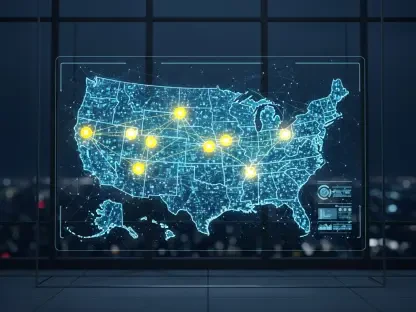
At its essence, georouting technology leverages location-based data to direct communications to the most relevant and nearby resources during a crisis. By pinpointing a user’s geographic position, often through GPS or mobile network data, it ensures that a distress call or text is routed to a local crisis center equipped to handle region-specific needs. This capability marks a significant departure from traditional, centralized call systems that often struggle with delays and mismatched resource allocation. The technology’s ability to bridge the gap between an individual in need and immediate, localized assistance underscores its importance in modern emergency frameworks.
The system comprises several integral components, including GPS integration for accurate location tracking, robust data processing systems to analyze and route information swiftly, and secure communication networks to maintain connectivity. These elements work in tandem to create a seamless flow of critical data, ensuring that responders are not only nearby but also contextually aware of local conditions. Such synergy positions georouting as a pivotal tool in the broader landscape of crisis response technology, where precision and speed are paramount.
Beyond its technical makeup, georouting stands out for its adaptability to various emergency scenarios, from mental health crises to natural disasters. Its relevance lies in tailoring support to the unique circumstances of each user, a feature increasingly vital in an era where personalized solutions are expected across sectors. As a result, this technology is not merely a tool but a cornerstone of efficient, empathetic crisis management systems worldwide.
Key Features and Technical Breakdown
Location-Based Routing Mechanism
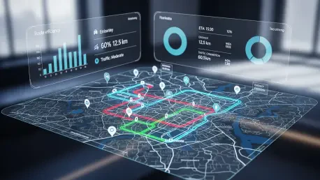
The hallmark of georouting technology is its location-based routing mechanism, which identifies a user’s position with remarkable accuracy and channels their communication to the nearest crisis center. This process often relies on real-time data from mobile devices, ensuring that help is dispatched from a facility familiar with the caller’s regional challenges, whether urban congestion or rural isolation. Such precision significantly reduces response times, a critical factor when dealing with life-threatening situations.
Performance-wise, this mechanism excels in high-pressure environments by minimizing the risk of misrouting, a common issue in older systems where calls could be sent to distant or unrelated centers. The ability to connect individuals with responders who understand local dialects, resources, and infrastructure amplifies the effectiveness of interventions. This feature’s role in the overall crisis management ecosystem cannot be overstated, as it directly impacts the likelihood of positive outcomes in emergencies.
Integration with Crisis Hotlines
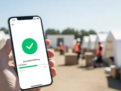
A standout application of georouting is its integration with crisis hotlines like the 988 service, designed to support mental health emergencies in the United States. Here, the technology processes text messages and voice calls, routing them to local centers based on the user’s location rather than a generic national hub. This integration involves sophisticated backend systems that handle data securely while ensuring uninterrupted connections, even during peak demand periods.
In real-world scenarios, this setup has proven invaluable, particularly in emergencies where users may struggle to articulate their location due to distress or other barriers. By automating the connection to nearby resources, georouting eliminates a critical delay, allowing responders to act swiftly with relevant local knowledge. The seamless operation of this feature in high-stakes situations highlights its technical reliability and underscores its potential for broader adoption across emergency services.
Recent Innovations Driving Georouting Forward
The evolution of georouting technology has accelerated in recent times, with significant strides in location data accuracy through enhanced GPS algorithms and tighter integration with mobile network infrastructures. These advancements ensure that even in areas with weak signals or dense urban settings, the system can pinpoint a user’s position with minimal error. Such improvements are crucial for maintaining trust in the technology, especially when every moment matters.
Emerging trends also point to the incorporation of artificial intelligence to predict crisis hotspots by analyzing historical data and current patterns. This predictive capability could enable preemptive resource allocation, ensuring that areas prone to higher distress calls are adequately staffed. Additionally, policy shifts are beginning to mandate georouting in mental health support frameworks, reflecting a growing recognition of its efficacy in enhancing public safety.
Another notable development is the exploration of georouting’s compatibility with next-generation communication technologies, such as 5G networks, which promise faster data transmission and broader coverage. This synergy could further reduce latency in crisis communications, making interventions even more immediate. As these innovations unfold, they signal a robust trajectory for georouting to become an indispensable asset in emergency response arsenals.
Real-World Impact in Crisis Situations
Georouting technology has found profound application in mental health crisis interventions, most notably through its deployment with the 988 hotline. By routing texts and calls to local centers, it ensures that individuals receive support from professionals who are familiar with community-specific resources, cultural nuances, and logistical realities. Case studies have shown improved response times and user satisfaction, validating the technology’s practical benefits in high-stakes contexts.
Beyond mental health, georouting has demonstrated versatility in disaster response coordination, where it facilitates the rapid dissemination of localized emergency alerts. For instance, during natural calamities, the technology can direct affected individuals to nearby shelters or aid stations, optimizing rescue and relief efforts. These implementations reveal georouting’s capacity to adapt to diverse emergency needs, enhancing overall societal resilience.
A particularly compelling use case involves rural areas, where access to crisis services can be limited by distance and sparse infrastructure. Georouting helps bridge this gap by connecting users to the closest available support, even if it requires cross-jurisdictional coordination. Such applications highlight the technology’s role in leveling disparities in emergency access, ensuring that geography does not dictate the quality of care received.
Challenges and Barriers to Overcome
Despite its promise, georouting technology faces several hurdles that temper its widespread adoption. Technical limitations, such as inaccurate location data in certain environments like underground spaces or remote regions, can undermine its reliability. These inconsistencies pose a risk of misrouting, potentially delaying critical assistance when it is most needed.
Privacy concerns also loom large, as the use of location data raises questions about user consent and data security. Ensuring that personal information is protected against breaches or misuse is paramount, especially in an era of heightened scrutiny over digital privacy. Compliance with regulations like the California Consumer Privacy Act adds another layer of complexity, requiring robust safeguards that do not compromise functionality.
Additionally, regulatory and logistical barriers can impede the seamless rollout of georouting across different regions. Variations in local policies, funding for crisis centers, and technological readiness create uneven implementation landscapes. Ongoing development efforts aim to address these issues through improved encryption, standardized protocols, and public-private partnerships, but the path to universal adoption remains fraught with challenges.
Future Prospects for Georouting in Crisis Support
Looking ahead, georouting technology holds immense potential to redefine crisis management through deeper integration with wearable devices and IoT ecosystems. Imagine smartwatches automatically transmitting distress signals with precise location data during a medical emergency, enabling responders to act before a user even makes a call. Such advancements could expand the technology’s reach beyond traditional communication channels.
Another promising avenue is the development of privacy-preserving location tracking methods, which could mitigate current concerns by anonymizing data while retaining routing accuracy. Research into differential privacy and federated learning models suggests a future where georouting balances efficacy with ethical data handling. These innovations could reshape public perception, fostering greater trust in the system.
Over the long term, georouting’s impact on mental health and emergency response systems could be transformative, particularly if paired with global standardization efforts. As it evolves from a niche tool to a universal standard, its ability to save lives and enhance community safety will likely influence policy and funding priorities. The trajectory points toward a more connected, responsive crisis infrastructure, provided current limitations are addressed.
Final Reflections on Georouting’s Journey
Reflecting on the exploration of georouting technology, it becomes evident that its integration into crisis support systems marks a significant leap forward in response efficiency and localization. The detailed examination of its features, from location-based routing to hotline integration, reveals a robust framework that has already improved outcomes in real-world emergencies. Challenges like privacy concerns and technical inaccuracies are acknowledged as substantial hurdles that demand attention during its rollout.
Looking back, the innovations and applications discussed underscore a technology that has begun to reshape how emergencies are handled, particularly in mental health contexts. To build on this momentum, stakeholders need to prioritize investment in accuracy-enhancing tools and privacy safeguards over the coming years. Collaborative efforts between tech developers, policymakers, and crisis centers are essential to refine georouting’s capabilities.
As a next step, pilot programs testing georouting with emerging technologies like 5G and wearables offer a practical way to address existing gaps. These initiatives, coupled with public education on data usage, could pave the way for broader acceptance and trust. Ultimately, the focus must remain on ensuring that georouting evolves into a reliable, equitable solution for all communities in need.