
Technological gaps in the National Weather Service’s network mean that some of the most densely populated areas in the South lack adequate low-altitude visibility. For decades, the National Weather Service and the National Oceanic and Atmospheric Administration served as the undisputed guardians of American atmospheric safety, utilizing a centralized network of radar stations to provide warnings. However, the current landscape of 2026 reveals that this traditional infrastructure is increasingly unable to keep pace with the volatile weather patterns driven by shifting global climates. As the frequency and intensity of storms escalate, many municipalities find themselves operating in a state of atmospheric blindness, where federal equipment fails to detect localized but dangerous phenomena. This growing crisis of visibility has prompted a fundamental shift in how communities approach meteorological defense, moving away from a purely federal reliance toward a decentralized model. By investing in supplemental private-sector technologies, local governments are now constructing their own safety nets to bridge the gaps where federal sensors reach their physical or technical limits, ensuring that no community is left vulnerable due to its geographic distance from a national radar hub.
The Wake-Up Call: Unpredicted Weather Events
A pivotal moment for this movement toward localized detection occurred recently in Lee County, Florida, when a tornado touched down without any prior warning from federal agencies. Despite being under the jurisdiction of major forecast offices, the storm remained entirely invisible to their systems because the atmospheric disturbance occurred at an altitude too low for distant sensors to capture. The resulting damage to residential properties and the injuries sustained by residents served as a stark reminder that a lack of local visibility can have life-altering consequences. This incident highlighted a growing problem where regional weather offices, often located hundreds of miles away, simply cannot see what is happening on the ground in distant counties. For public safety officials, the Lee County event proved that relying solely on distant federal sensors is no longer a viable strategy for protecting lives. When a community is located far from a National Weather Service office, the delay in detection can mean the difference between a timely alert that allows families to seek shelter and a catastrophic surprise that leaves them defenseless.
The investigation into the Lee County incident revealed a significant and dangerous disconnect between the reality on the ground and the data displayed on federal radar screens. Even as residents were experiencing high winds and debris, the official radar maps showed clear or minimally turbulent skies because the radar beams were scanning thousands of feet above the actual funnel cloud. For emergency managers, this gap in intelligence created a paralysis that prevented them from deploying resources or activating sirens until the damage had already been done. This event catalyzed a broader discussion among municipal leaders regarding the necessity of owning their own weather data rather than being passive recipients of information that may be incomplete. It became clear that the traditional top-down model of weather reporting was failing to address the needs of modern cities that require granular, real-time intelligence to manage local emergencies effectively. Consequently, the focus shifted from asking for better federal coverage to actively pursuing independent technological solutions that could offer the precision necessary for modern disaster response.
Technical Constraints: Understanding Radar Gaps
The phenomenon known as a radar gap is at the heart of this meteorological crisis, stemming from the fundamental laws of physics rather than simple equipment failure. These gaps exist because radar beams travel in straight lines while the surface of the Earth is curved, creating an inevitable blind zone. As a radar beam travels further from its source, it gains altitude relative to the ground, meaning that at a distance of 100 miles, the beam may be scanning several thousand feet in the air. This height differential leaves a massive void near the ground where dangerous weather, such as microbursts or developing tornadoes, can form and dissipate without ever being hit by a pulse from a federal radar station. This geometry of the atmosphere means that even the most advanced national systems have inherent physical limitations that cannot be solved by software updates alone. For communities located in these geographic dead zones, the lack of low-level visibility represents a persistent threat that requires a different technological approach to overcome the curvature of the Earth.
The inherent risks of these radar gaps are compounded by the physical age and placement of existing federal infrastructure across the United States. Many of the Nexrad stations currently in operation were commissioned years ago, and while they have undergone various software upgrades, the physical distribution of these towers has not kept pace with the expansion of suburban and urban centers. As populations shift, more people are moving into the very regions that sit on the fringes of federal radar coverage, increasing the number of people at risk during undetected events. Furthermore, many of the most dangerous short-fused weather events originate and intensify at altitudes below two thousand feet, which is well below the scanning floor of many national systems in remote areas. This leaves millions of citizens in regions where the most immediate environmental threats are often the most difficult to track with national equipment. This technical reality has forced local leaders to recognize that the only way to gain a clear picture of their own atmosphere is to deploy sensors that are closer to the ground and closer to the communities they serve.
The Landscape: Shifting Political and Economic Realities
The push for local technological investment is driven by fiscal reality as much as it is by immediate safety concerns in the current year. Recent years have seen significant turmoil within federal agencies, including budget cuts and organizational instability that have slowed the pace of innovation. These disruptions have hindered the ability of the National Weather Service to modernize its aging equipment or expand its reach into underserved geographic zones, leaving local governments to fend for themselves. For many state and local leaders, the realization has set in that federal help is not coming fast enough to keep up with the increasing severity of storm seasons. This has created a sense of urgency to find alternative funding models that do not rely on the unpredictable nature of federal budget cycles. By taking control of their own meteorological infrastructure, cities are attempting to insulate their public safety departments from the political and financial volatility that often plagues national-level organizations.
Furthermore, the expiration of several federal funding programs has left state and local leaders with a massive financial void that they must now fill through municipal bonds or private partnerships. Many officials have realized that public tax dollars alone will never be sufficient to solve every infrastructure gap, especially as climate-related disasters become more frequent and expensive. This has forced a new sense of independence among local governments, who must now find creative ways to fund their own resilience efforts regardless of the stability of federal support. The transition to a more self-reliant model involves a pragmatic assessment of risk, where the cost of investing in private weather technology is weighed against the potential millions of dollars in uninsured losses from an unpredicted storm. This shift in economic strategy marks the end of an era where federal agencies were the sole providers of weather intelligence, paving the way for a more competitive and diversified market of meteorological tools that cater specifically to the needs of local decision-makers.
Localized Solutions: Specialized Private Technology
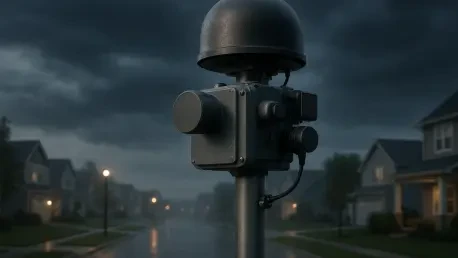
To create a more granular picture of local weather, municipalities are increasingly deploying a suite of specialized private-sector tools designed to provide high-definition metrics. The goal of these initiatives is not to replace the existing federal data but to fill the holes with supplementary intelligence that offers a higher degree of precision. These systems provide real-time intelligence that allows emergency managers to make better-informed decisions during rapidly evolving situations, such as deciding exactly when to close a bridge or evacuate a low-lying neighborhood. Private tech companies now offer compact, high-resolution radar units that can be installed on existing city infrastructure, such as cell towers or water tanks. These units scan the atmosphere at much lower altitudes than federal systems, providing a clear view of the bottom few thousand feet of the sky. By integrating these high-frequency updates into their command centers, local officials can see a level of detail that was previously unavailable, allowing them to track the exact path of a storm through a specific neighborhood.
Beyond low-level radar, the deployment of tidal gauges and weather intelligence platforms provides a constant stream of data on water levels and air quality that is specific to a city’s unique geography. These sensors can detect rapid rises in water levels in urban drainage systems or identify micro-climates within a city that may be more susceptible to flash flooding. By integrating these private sensors into their daily workflows, local officials can construct a comprehensive big picture that accounts for the nuances of their specific environment. For example, a coastal city might combine private radar data with real-time tidal sensor readings to predict exactly which streets will become impassable during a storm surge. This hyper-local data allows for a surgical approach to emergency management, where warnings can be issued to specific blocks rather than entire counties. The use of these specialized tools represents a move toward data-driven governance, where the safety of the public is secured through a dense network of local sensors that provide a continuous, high-fidelity pulse of the environment.
Strategic Alliances: The Evolution of Public-Private Partnerships
This technological shift has necessitated the rise of the Public-Private Partnership as the primary vehicle for modernizing local weather defense. However, this transition requires a delicate balance between the rapid innovation of private companies and the public safety mandates of government agencies. Both government officials and technology providers agree that these tools must be viewed as essential supplements to, rather than replacements for, the established work of the National Weather Service. The challenge lies in ensuring that private data is reliable enough to be used for life-and-death decisions while also being affordable enough for smaller municipalities to implement. For these partnerships to be successful, there must be a high degree of transparency regarding how data is collected and processed. This collaborative environment has allowed private firms to tailor their products to the specific needs of emergency managers, resulting in interfaces that are more intuitive and data that is more actionable than traditional federal feeds.
For these partnerships to remain effective, private data must be operationalized so that it works seamlessly within existing federal and state emergency management environments. Local governments often subject these tech providers to intense scrutiny to ensure their tools meet specific community needs and can survive the harsh conditions of a major storm. This pragmatic approach allows cities to break out of traditional problem-solving ruts and find innovative ways to bypass federal barriers that have historically slowed down the adoption of new technology. By fostering a competitive market for weather data, local governments are driving down costs and encouraging the development of more robust sensors. This evolution of the public-private dynamic has turned cities into incubators for meteorological innovation, where new tools are tested in real-world scenarios before being adopted on a wider scale. The result is a more resilient and flexible safety infrastructure that can adapt to the specific threats faced by a community, regardless of the limitations of the national network.
Resilient Futures: Managing Climate Impact Locally
Climate change acts as a threat multiplier in the current environment, making weather patterns more extreme and unpredictable with every passing season. While federal agencies grapple with large-scale logistical and political challenges, the front line of climate impact is always at the local level, where the physical consequences of a warming planet are felt most acutely. City and county leaders are the ones responsible for managing the immediate aftermath of hurricanes, floods, and unpredicted tornadoes, making them the primary stakeholders in atmospheric visibility. As a result, the responsibility for climate resilience is becoming increasingly localized, with municipalities taking the lead on environmental monitoring. The future of disaster management appears to be heading toward a model of hyper-localism, where individual counties monitor their own territory with a level of detail a national agency cannot match. By leveraging private innovation to bridge federal radar gaps, local authorities are building a more responsive system capable of adapting to a volatile and rapidly changing environment.
In the end, the movement toward local resilience proved that the wait for federal intervention was no longer a viable policy for proactive city leaders. The transition to hyper-local monitoring required cities to stop viewing weather data as a distant service and start treating it as essential local infrastructure. Successful municipalities moved forward by establishing dedicated departments for atmospheric intelligence, ensuring that every dollar spent on private sensors was integrated directly into emergency response protocols. This shift ensured that the responsibility for climate resilience became a localized priority, where individual counties monitored their own territory with a level of precision that national agencies could never match. Looking ahead, the integration of these private technologies into the broader public safety framework provided a blueprint for how other regions could bypass federal inertia to protect their residents. By prioritizing these high-resolution localized networks, communities transformed themselves from passive recipients of federal warnings into proactive managers of their own environmental security, providing a roadmap for a safer and more prepared future.