
The architectural landscape of coastal California cities often faces significant friction between the necessity of modern housing infrastructure and the rigid preservation of historic community character. In Half Moon Bay, this tension reached a critical peak this quarter as local officials decided to postpone the downtown map amendment until the upcoming November election cycle. This strategic delay serves as a calculated response to a surge in public discourse regarding high-density zoning and environmental stewardship within the historic district. While the city council originally aimed for a more immediate administrative resolution, the complexity of aligning various neighborhood interests necessitated a broader democratic mandate. By moving the decision to the ballot, the city ensures that the long-term vision for its core commercial and residential corridors is directly shaped by the electorate. This shift reflects a growing trend where municipalities prioritize public consensus over rapid implementation.
Policy Dynamics: Navigating Regulatory Frameworks and Public Interest
Urban Planning: Zoning and Land Use Revisions
The process of redrawing the downtown map involves more than just shifting boundary lines on a piece of paper; it requires a comprehensive overhaul of existing Land Use Plan designations. Local planners have spent the last few months evaluating how the proposed changes would influence local traffic patterns, water usage, and the preservation of open spaces. The amendment aims to consolidate various zoning districts to allow for more flexible residential-commercial mixed-use developments, which proponents argue is essential for the economic vitality of the region. However, critics of the plan have raised concerns about the potential for overdevelopment and the erosion of the small-town atmosphere that defines the coastal community. Consequently, the transition to a ballot measure provides a necessary cooling-off period, allowing for additional environmental impact reports and traffic studies to be completed. This period of reflection is intended to produce a more refined proposal for residents.
Social Integration: Procedural Integrity and State Mandates
Building on the technical requirements of the coastal development permit system, the city council highlighted the importance of transparency in the decision-making process. The decision to shift the amendment to the ballot reflects a commitment to procedural integrity, ensuring that every registered voter has the opportunity to weigh in on the future density of the downtown core. This approach is particularly relevant as the city navigates the mandates from the California Coastal Commission, which often requires rigorous documentation of public access and environmental protection. By allocating more time before the final vote, the administration can better align its local zoning goals with state-level housing requirements that demand increased affordability and accessibility. Furthermore, this delay allows for a series of town hall meetings and workshops designed to demystify the zoning language for the average citizen. Such educational initiatives are crucial for building the social capital for success.
Strategic Implementation: Digital Tools and Future Growth Patterns
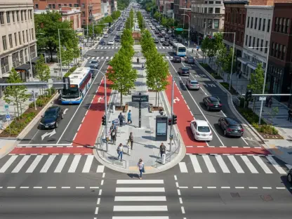
Digital Infrastructure: GIS Mapping and Simulation Tools
Modern urban planning relies heavily on advanced Geographic Information Systems to visualize the impact of zoning changes on specific neighborhoods and streetscapes. The Half Moon Bay planning department has utilized high-resolution digital twin technology to model how new height limits and setbacks would alter the skyline and sunlight exposure in the downtown area. These simulations have become a cornerstone of the debate, providing residents with a realistic view of what the proposed amendment actually means for their daily lives. By integrating this technology into the public review process, the city has been able to identify potential bottlenecks in pedestrian flow and transit accessibility that were not immediately apparent in traditional static maps. The interactive nature of these digital models allows stakeholders to propose modifications in real-time, fostering a more collaborative environment for urban design. This technological transparency is expected to play a major role in the voter decisions.
Collaborative Roadmap: Infrastructure and Transit Strategy
The city’s decision to move the amendment to the ballot ultimately prioritized long-term stability over immediate progress, reflecting a mature approach to coastal governance. This strategy emphasized the need for a unified community vision that balanced growth with environmental sensitivity and historic preservation. Moving forward, the city council established a clear roadmap for the next few months, focusing on the refinement of building codes and the enhancement of public infrastructure. Residents were encouraged to participate in upcoming design charrettes to provide direct input on the aesthetic guidelines for new developments. Furthermore, local officials initiated a deeper collaboration with regional transit authorities to ensure that any increase in downtown density was supported by robust public transportation options. By taking these proactive steps, the administration transformed a potential political impasse into a structured opportunity for civic engagement and technical optimization of the core.